Revelstoke - Frisbee Ridge and Keystone Standard Basin
One autumn weekend in 2012 a group of us headed up to check out the much-heralded Monashee and Columbia mountain range trail duo - Frisbee Ridge a new, custom built hike / bike trail, and Keystone Standard Basin a legendary hike / bike trail.
We found much of the information that we needed online (bikerevelstoke.org) and arranged for accommodations at the local KOA for six in two log cabins. We also spoke with both local bike shops and heard some interesting BETA on a DH section of trail that was referred to as “challenging” and “you guys should have no problem” (false ego stoke?).
Our chalets were comfortable and conveniently located near Revelstoke and the highway routes to both trailheads; Frisbee’s Westside Rd. and Keystone’s Nakusp-Mica Cr. Hwy. 23
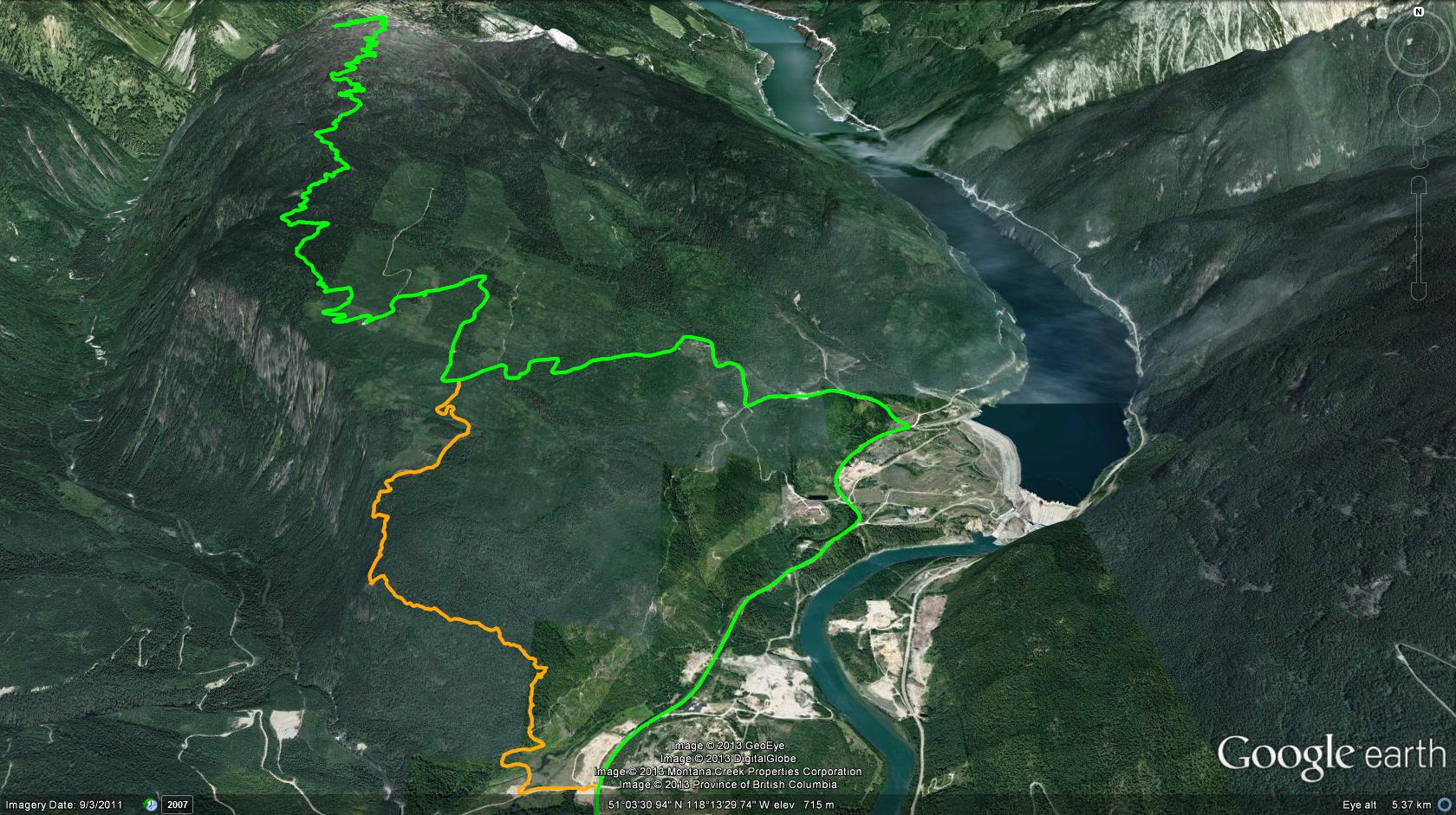
Day one found us heading up to Frisbee Ridge. Gaining the trailhead included a 6km jaunt west on the Trans-Canada Hwy., a right onto Westside Rd., just over the Columbia River bridge and a 3.8km drive to the location of what would be a left-hand turn onto the bottom drop-vehicle location.
We rode mountain bikes for this adventure; hikers (and shuttlers alike) will find themselves continuing 4.5km north along Westside Rd., where Frisbee Rd. appears as a left-hand turnoff. (Revelstoke Dam is on your right at this point). Up you go along a fairly well maintained gravel road for 9.3km, the route is well signed, ending at a small parking area with outhouse and amazing views across to the east and southeast; Mt.Revelstoke, Mt.MacKenzie, Mt.MacPherson. This is a nice place :-)
Singletrack commences from the parking area, climbing gently but relentlessly to the Frisbee Ridge summit. The physical and mechanical labor employed in the creation of this trail is evident everywhere along its length; a huge pint to the sky for the lads and lasses who gave us this trail!
As with most BC mountains, June through early Sept. finds the alpine lush with countless varieties of wildflower… and the air thick with bugs. Our Sept. 15th adventure found us in the last dwindling vestiges of flowers, few bugs, amazing weather and inspiring views in all directions! The bugs vs. flowers tradeoff was one I accepted, having been saturated in wildflowers all summer in the Okanagan- Similkameen.
We met many fellow trail-users, perhaps 50/50 hikers-bikers, and smiles all around. The summit also holds a moderate descent to a small pond and cabin; a bit of a grunt down and back out, but well worth a look. The descent from the summit to your vehicle drop-zone will astound you with its length. Sure, the climb felt like a long one, but the sheer volume of uber-flowy, well-engineered upper singletrack, along with the challenging DH section has to be experienced to be appreciated; 1548m / 5000 vertical feet of drop in one beauty roll. This is currently my ‘new favorite’ BC singletrack trail!
The lower DH section is not yet connected with the main parking area, as such, when you drop down to the main parking area, you also have the opportunity to continue via a DH trail to the bottom vehicle or just call it a day and drive down the service road. Advanced riders, or extremely fit hikers - may wish to travel down the Frisbee Rd. for a distance of 3.2km, where a FST junction appears on your right. This jct. is 100m beyond the 2nd major switchback on your way back down Frisbee Rd.
Travel this smaller, unsigned FSR south for a distance of 1.6km, where, despite the fact that you’ll be wondering “is this the correct road”?, you will eventually find a small, cairn-marked trailhead on your left; down ya’ go! The trail is ‘DH’ (black to double-black diamond difficulty rating) through and through, so if you are not a confident, skilled and armored rider - skip this 4km DH section. Hikers may find this trail section loose, as the route truly requires a bit of work to make it anywhere near sustainable…
Play the car-shuttle game as necessary - or be as lucky as us and have one rider who didn’t feel up to riding the DH section drive the shuttle vehicle down to meet us at the original drop point; I wholeheartedly recommend this strategy! Cheers; a convenient liquor store is located at 109 E Victoria Rd., groceries are just up the street at Cooper's Foods, 555 Victoria Rd. and for those not inclined to cook, check out The Nomad, a classic diner located at, 1601 Victoria Rd.
Keystone Standard Basin Day two was a little harder to get up to, as physical exhaustion from Frisbee Ridge and too much food and wine the night before was felt by all. We packed up our sorry buts and headed west on the Trans-Canada Hwy. for a distance of 4.7km to the Nakusp-Mica Cr. Hwy. 23 junction, appearing on your right. Head north along #23 for a distance of 50.6km (!) where a marked FSR appears on your right. Follow the FSR for 16.2km, occasional signage reassures you that you are on the right track.
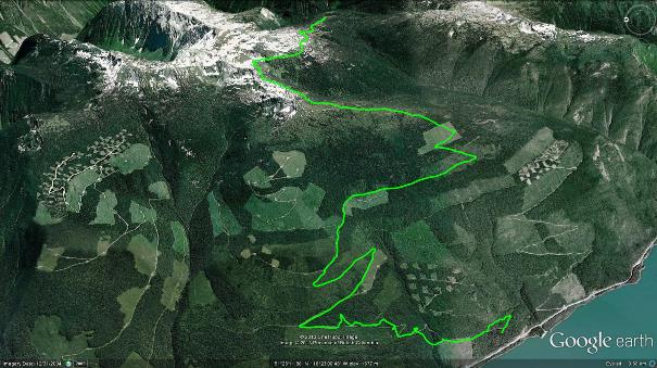
A parking lot caps the road ascent, and from here one can see Cat Peak and the amazing Bourne Glacier ice fields to the south west; impressive and beautiful! You’ll need strong climbing skills in order to remain rubber side down for the first few kilometers if mountain biking this trail. Thereafter, the climbing is relentless for perhaps 2.5km, yet the mind-blowing views help to allay some of the pain. Soon the ascent mellows into rolling singletrack through alpine meadows, circumnavigating the base of a bowl and climbing to a knoll 8km along - the high-point of this trail.
As with Frisbee Ridge, the summit of the Keystone Standard Basin trail is merely an invitation to drop down into a bowl which holds a small cabin and pond. The enjoyable 3km descent to the pond reappears as a grunt back up to the summit, but it’s well worth the visit. We met some really great people at both Frisbee and Keystone ponds and cabins, making this a de rigor ritual of trail-junkie bonding.
The rolling lay of the trail is such that the real descending does not begin until one makes their way back nearly six kilometers beyond the summit proper, this leaves you with perhaps 2.5km of true descending back to the parking lot. This doesn’t sound like much, buts it is enjoyable, and again, the vistas off in nearly every direction are truly amazing.
In closing, I highly recommend Revelstoke as a road-trip playground. The little community is pretty cool and different in so many ways, including trains! For those of you not from the South Okanagan - trains are something that we Okanaganites don’t see or hear very often.
I’d suggest that the KOA chalets are worth a look for accommodations. I don’t know much about other local establishments, but I’d love to hear your experiences, as I’d really like to be able to recommend some Revelstoke B&B’s.
Frisebee Ridge - 1522m Vertical Drop | Length: 21.7km
Keystone Basin - 1520m Vertical Drop | Length: 27.6km

