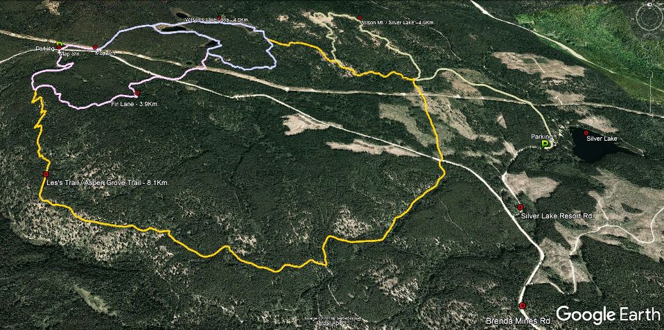
The Wilson Lakes trail network is a small 'locals' trail network that Peachland area residents have been hiking, biking, skiing and snowshoeing for more than 40 years. Click the image above to enlarge it, then visit our Google Earth listings to download and examine the GPS tracks.
The area was originally developed by Peachland residents decades ago, and some of the original signs still exist today, though the club may soon erect new signage throughout the area.
As such, please consider using the GPS (Google Earth or .GPX) files from this website, as the trail network is somewhat "a work-in-progress".
There exists two entrances to the trail network, both distances expressed below are measured from the junction of Princeton Ave. and Highway 97. Note that Princeton Ave. changes name to Brenda Mines Rd. partway along this adventure.
Parking - 15.2Km. up Brenda Mines Rd., at Silver Lake (the lake is 1km. up Silver Lk. Rd.)
Parking - 19.1Km. and 19.4Km. up Brenda Mines Rd., at the 'unnamed pulloffs'. (where some basic trail-maps exist)
The area has been logged about three years ago, so trails may be slightly vague in some areas.
Kudos to Chris King at the Peachland Outdoors Club for all of their help with all-things-trail in the Peachland area! Feel free to contact their club at peachlandoutdoors@gmail.com for more info'
Low:1063m | High:1394m | Length:Varies | Water:N/P | Cell:Spotty)
